| |
|
|
iLinks design and produce a
wide variety of products and solutions for the land and marine
mobile mapping markets. The cutting-edge design and production
of our products is based on over five decades of combined
experience in the survey market in some of the most hostile
environments in the world.
|
| |
|
|
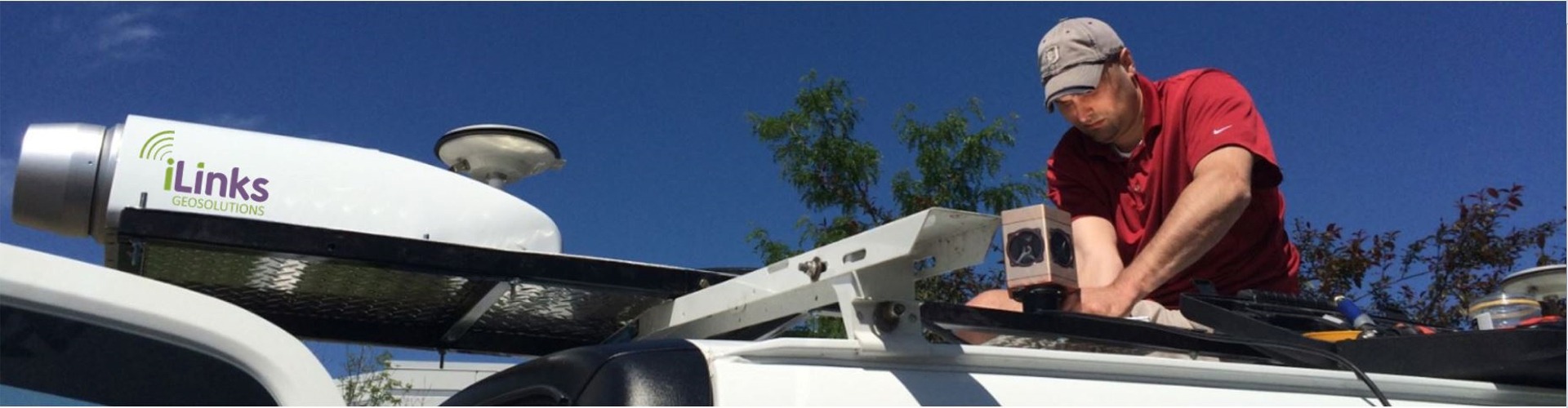
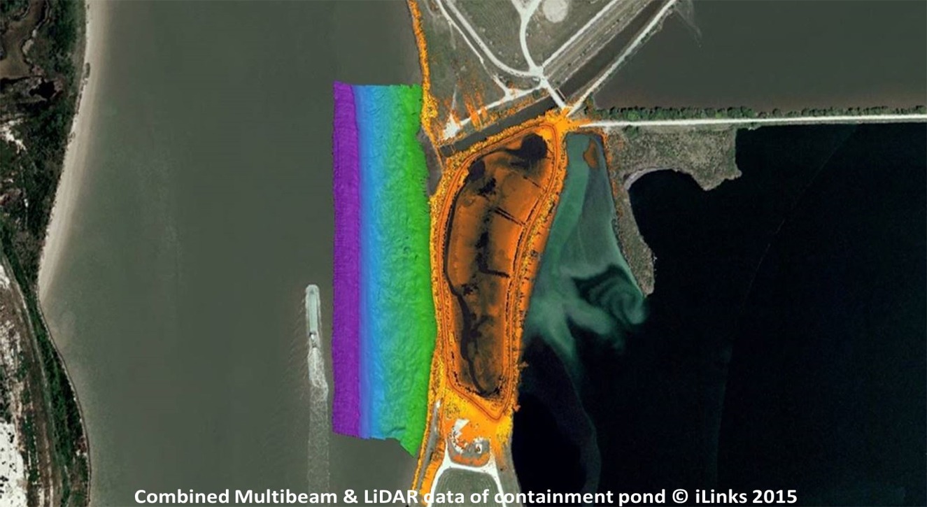
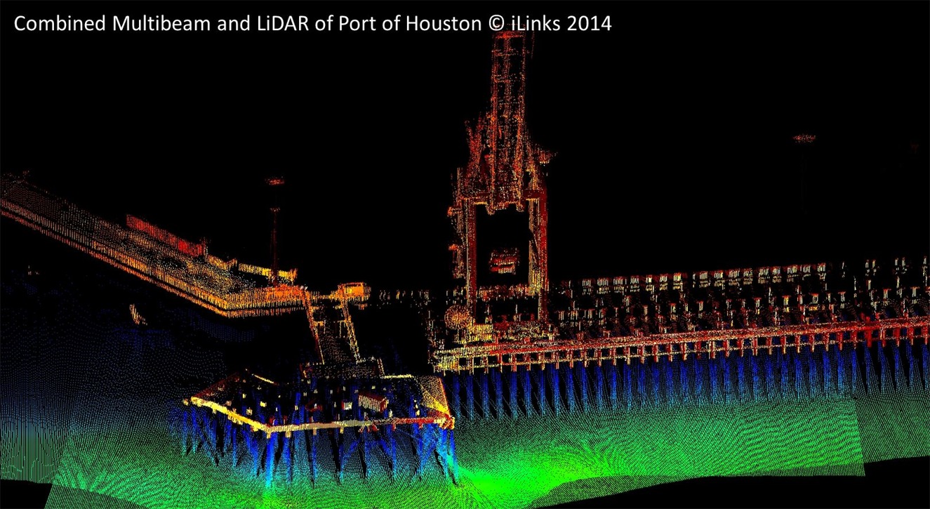
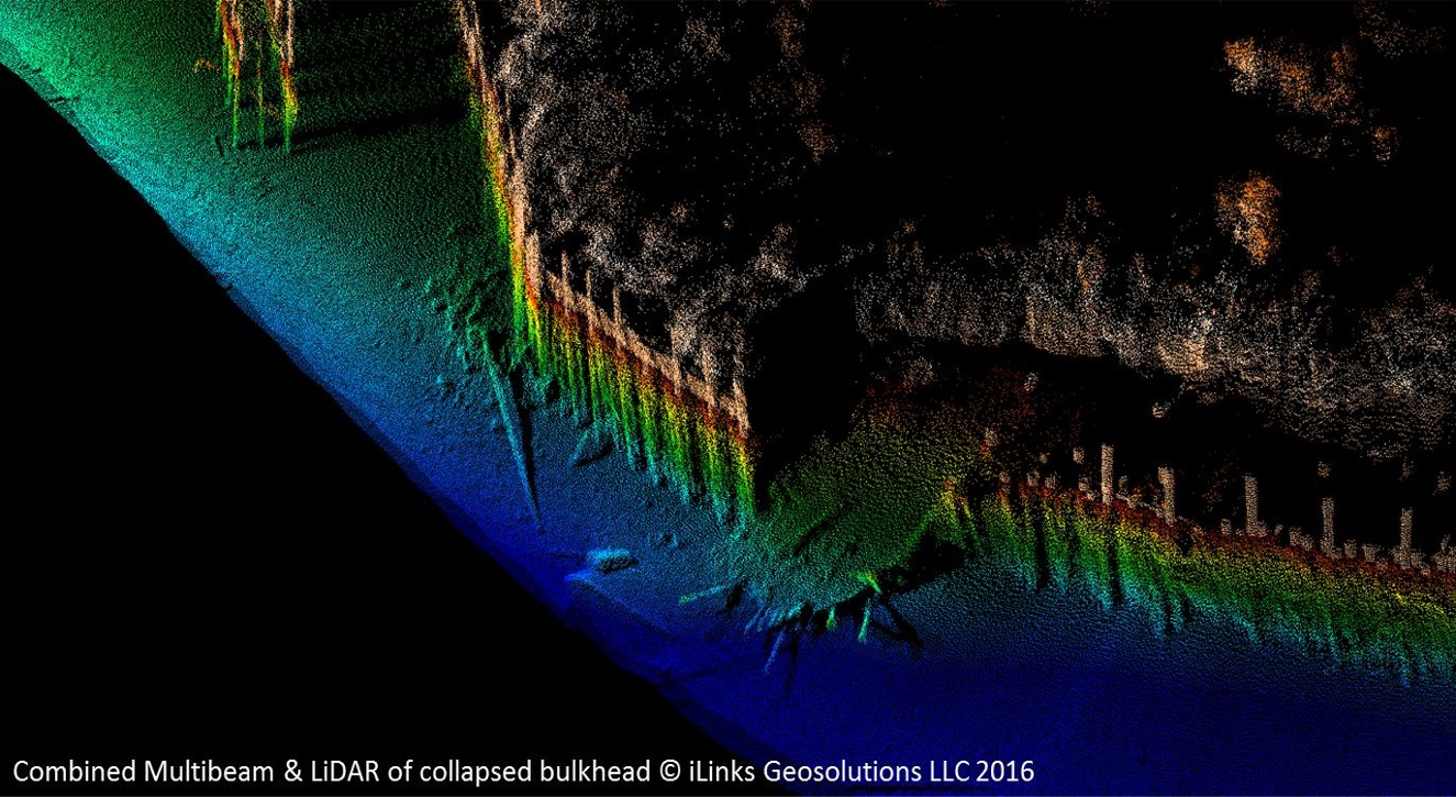
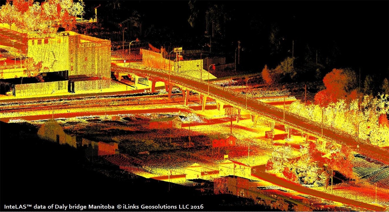
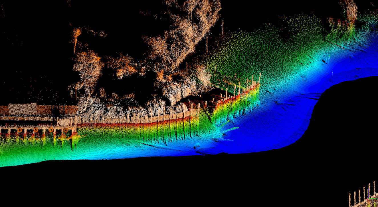
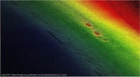
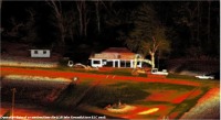
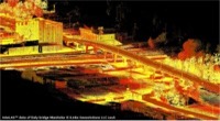
| Rapid Deployment Combined Multibeam and LiDAR
Systems |
| |
|
|
| |
|
|
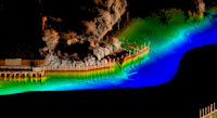
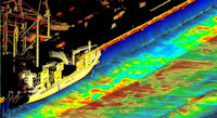
| Portable Mulibeam & LiDAR system |
BENEFITS |
APPLICATIONS |
 PMLS-1 Multibeam &
LiDAR System PMLS-1 Multibeam &
LiDAR System |
- Self-contained and transportable
- Factory measured fixed offsets
- Fully calibrated & ready to use
- Always maintains calibration
- Fits easily to almost any vessel
- Combined Multibeam & LiDAR data
- Real-Time 3D point cloud processing
- Uses Hypack, QINSy, EIVA, PDS2000
|
- Ports and Harbors
- Rivers and Canals
- Bridges and Locks
- Bulkhead inspections
- Engineering support
- Sea Defences
- Beach replenishment
- Reservoirs and Dams
|
| |
 |
 |
 |
 |
 |
|
|
Click on image to
enlarge |
Click on image to enlarge |
Click on image to
enlarge |
| |
|
|
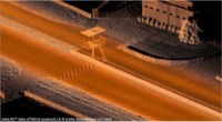
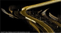
| Mobile LiDAR
Systems |
| |
|
|
| |
|
|
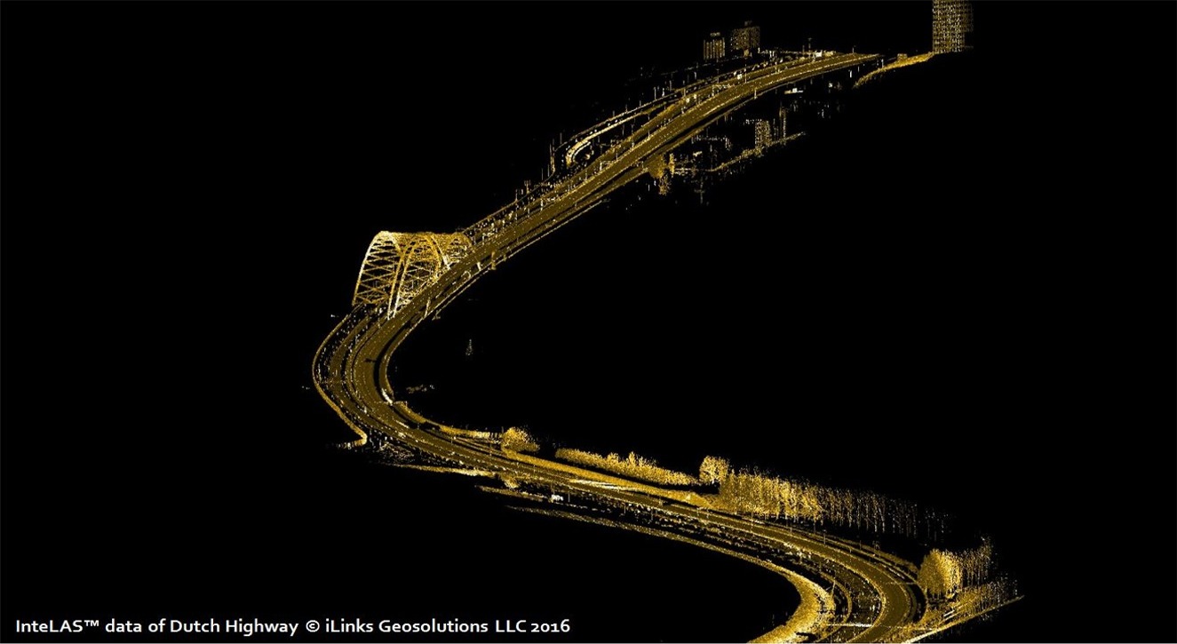
| InteLAS™ HD mobile LiDAR system |
BENEFITS |
APPLICATIONS |
 Velodyne HDL-32E
LiDAR sensor Velodyne HDL-32E
LiDAR sensor |
- Self-contained weatherproof POD
- Up to 700,000 points per second
- ± 1 cm accuracy and
100 m Range
- Integrated GNSS, INS, FOG
- Never requires
re-calibration
- Can be operated at highway speeds
- Real-time
geospatial 3D point cloud
- Optional data acquisition
software
|
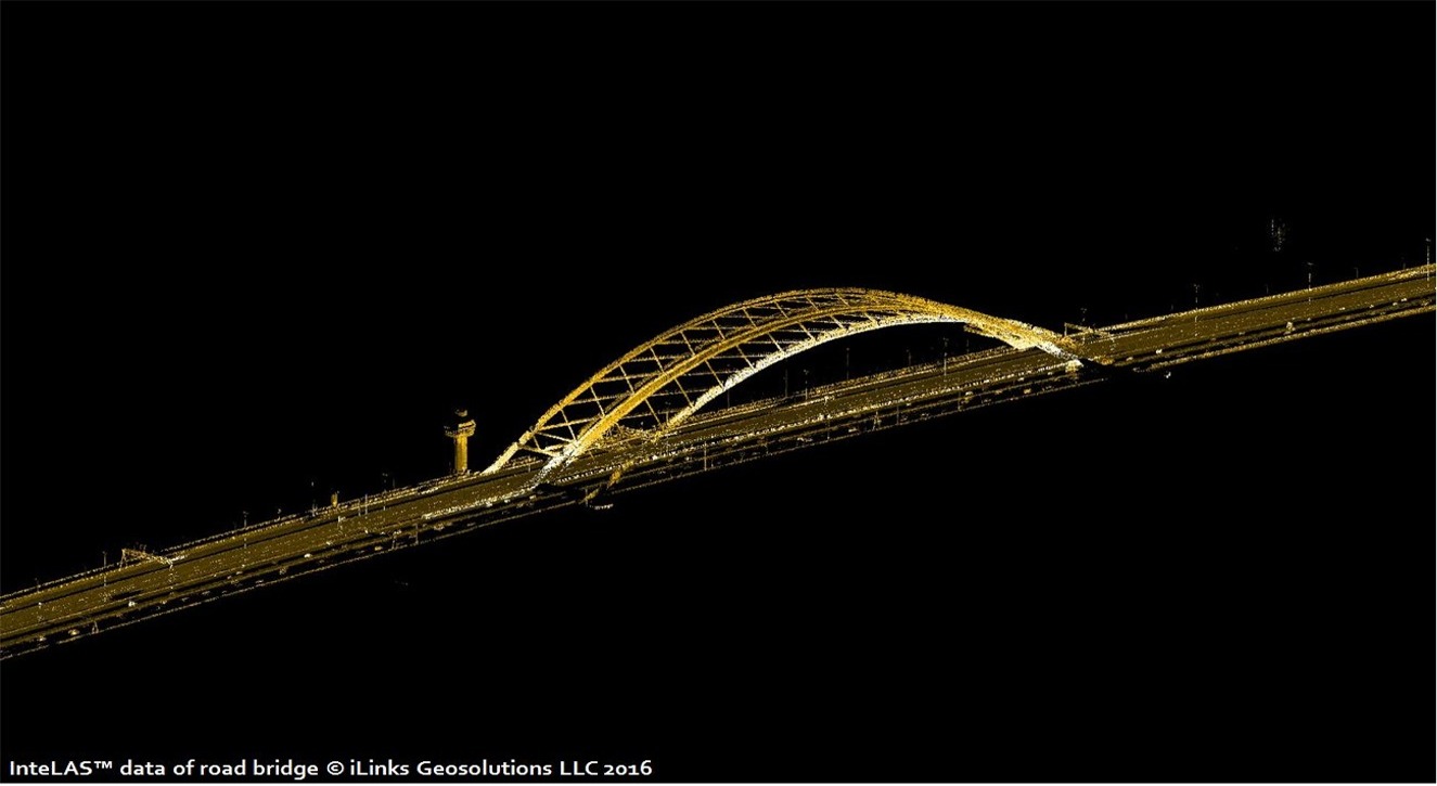
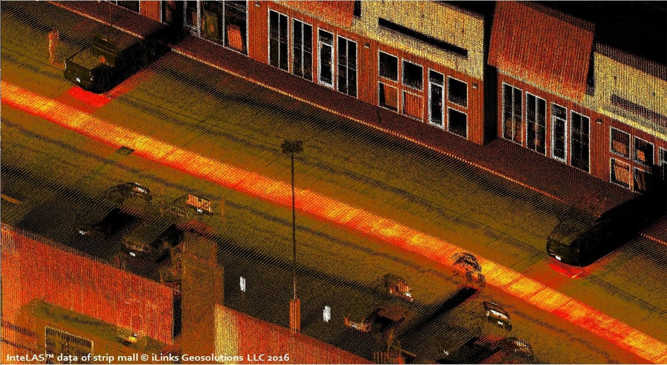
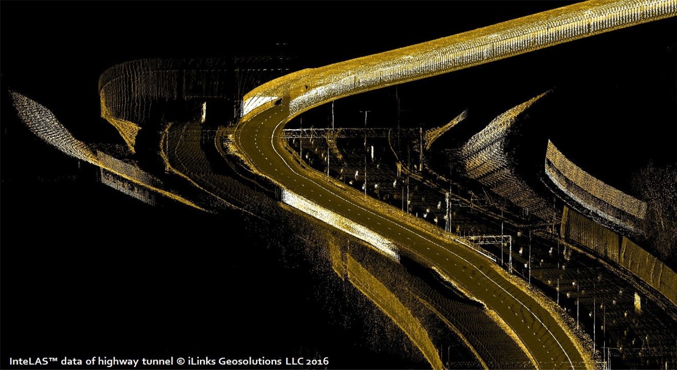
- Road and highway mapping
- Road and utility design
- Powerline surveys
- Right of way surveys
- Topographic modeling
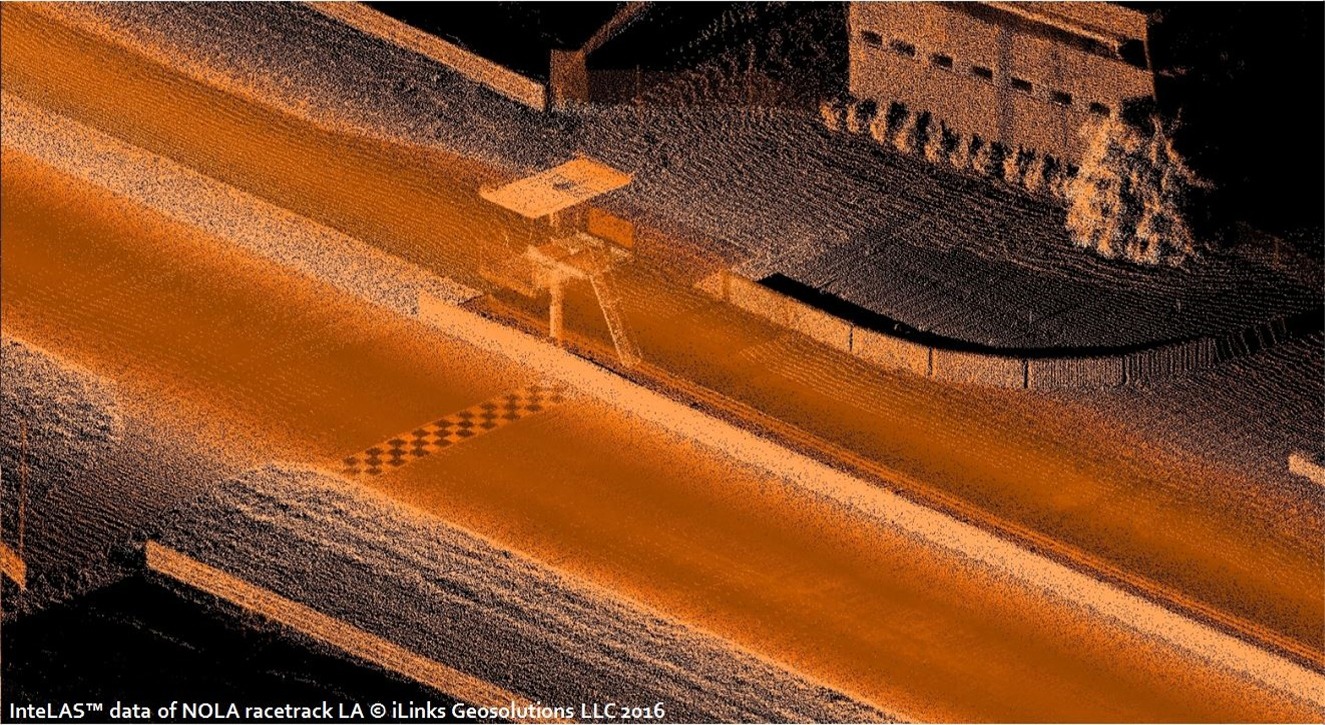
- Racetrack simulation surveys
- Civil engineering support
- Railroad planning and inspection
|
| |
|
|
| |
|
|
 |
 |
 |
|
|
Click on image to
enlarge |
Click on image to enlarge |
Click on image to
enlarge |
|
|
|
|
|
|
|
|
| InteLAS™ mobile LiDAR system |
BENEFITS |
APPLICATIONS |
 Velodyne VLP-16
LiDAR sensor Velodyne VLP-16
LiDAR sensor |
- Self-contained weatherproof enclosure
- Up to 300,000 points per second
- ± 3 cm accuracy and
100 m Range
- Integrated GNSS, INS, FOG
- Never requires
re-calibration
- Can be operated at highway speeds
- Real-time
geospatial 3D point cloud
- Optional data acquisition
software
|
- Road and highway mapping
- Civil engineering support
- Powerline surveys
- Mine and quarry planning
- Topographic modeling
- Inventory management
- GIS data collection
- Urban planning
|
| |
|
|
| |
|
|
 |
 |
 |
| Click on image to
enlarge |
Click on image to enlarge |
Click on image to enlarge |
| |
|
|
| |
|
|
| |
|
|
| InteLAS™
LR mobile LiDAR system |
BENEFITS |
APPLICATIONS |
 Renishaw M250 or
S250 LiDAR sensor Renishaw M250 or
S250 LiDAR sensor |
- Self-contained weatherproof enclosure
- Up to 36,000 points per second
- ± 1 cm accuracy and
250 m range
- Integrated GNSS, INS, FOG
- Never requires
re-calibration
- Suitable for marine applications
- Real-time
geospatial 3D point cloud
- Optional data acquisition
software
|
- Ports and harbors
- Coastal management
- Beach profiling
- Mine and quarry planning
- Topographic modeling
- Volume surveys
- Reservoirs and dams
- Urban planning
|
| |
|
|
| |
|
|
 |
 |
 |
|
Click image to enlarge |
Click image to enlarge |
Click image to enlarge |
| |
|
|
| |
|
|
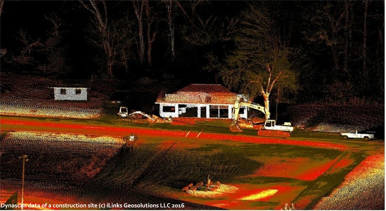
| Stand-alone LiDAR
Sensors |
| |
|
|
| |
|
|
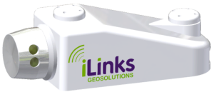
| InteLAS™
POD |
BENEFITS |
APPLICATIONS |
 Velodyne VLP-16 LiDAR sensor Velodyne VLP-16 LiDAR sensor |
- Self-contained weatherproof enclosure
- Up to 300,000 points per second
- ± 1 cm accuracy and 100 m range
- Integrated GNSS time-sync receiver
- 9 - 32 VDC Operation
- Single Ethernet connection to PC
- Multi-unit networking capability
- Simple to instal and calibrate
|
- Ports and harbors
- Coastal management
- Beach profiling
- Rivers and Canals
- Bulkhead inspections
- Locks and Dams
- Reservoirs and Lakes
- Environmental monitoring
|
| |
|
|
| |
|
|
 |
 |
 |
|
Click image to enlarge |
Click image to enlarge |
Click image to enlarge |
| |
|
|
| |
|
|
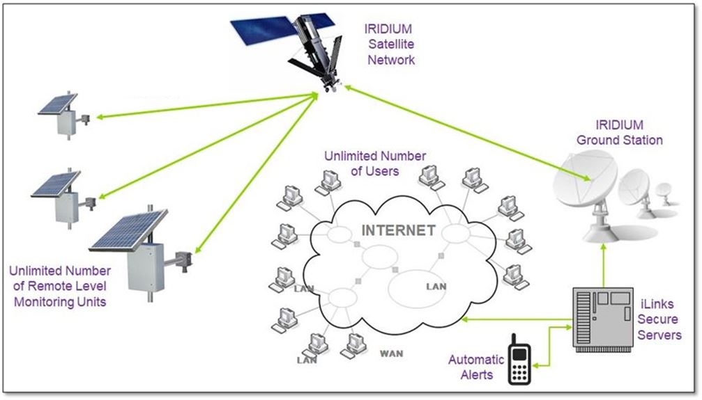
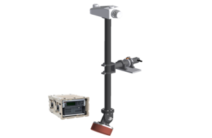
| Autonomous remote level monitor |
| |
|
|
| |
|
|
| iLevel - Remote level monitor |
BENEFITS |
APPLICATIONS |
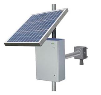 |
- Autonomous remote level monitor
- 10 m range with 1 cm accuracy
- Integrated Iridium satellite transceiver
- Onboard data processing and storage
- World-wide operation
- SOLAR constant power supply
- Rugged waterproof design
- Low monthly running costs
|
- Remote river level monitoring
- Flood early warning system
- Dam and reservoir monitoring
- Remote tide guages
- Fracking pond level monitoring
- Storeage tank levels
- Silo level monitoring
- Inland waterway navigation
|
| |
|
|
| |
|
|
| |
|
|