WORLD CLASS MOBILE SURVEYING PRODUCTS AND SERVICES
| Inland Waterways |
| iLinks provides combined
hydrographic and topographic surveying services which have been tailored
specifically to the maintenance and improvement of
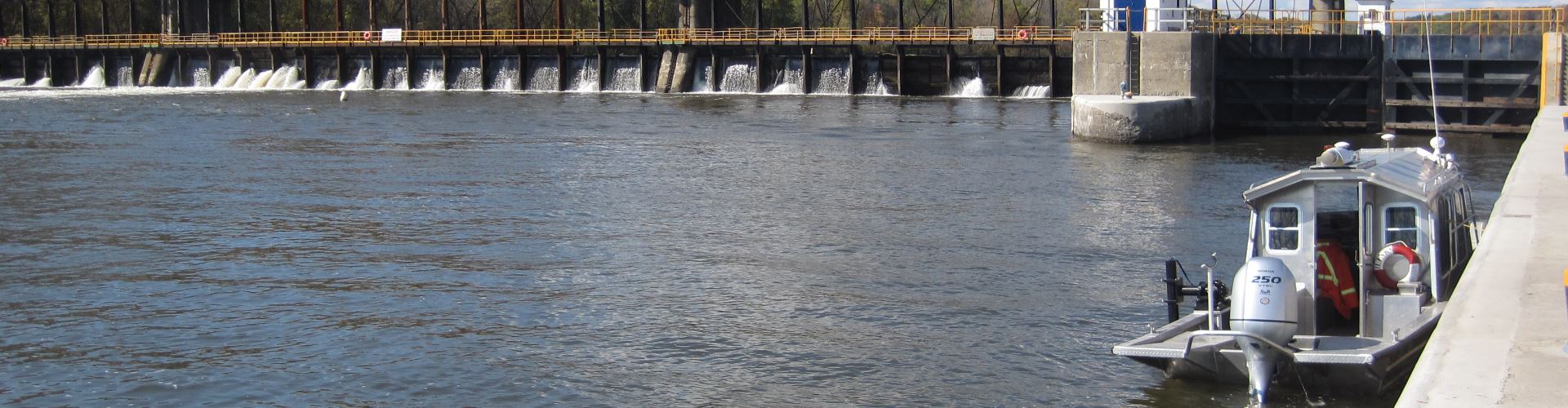
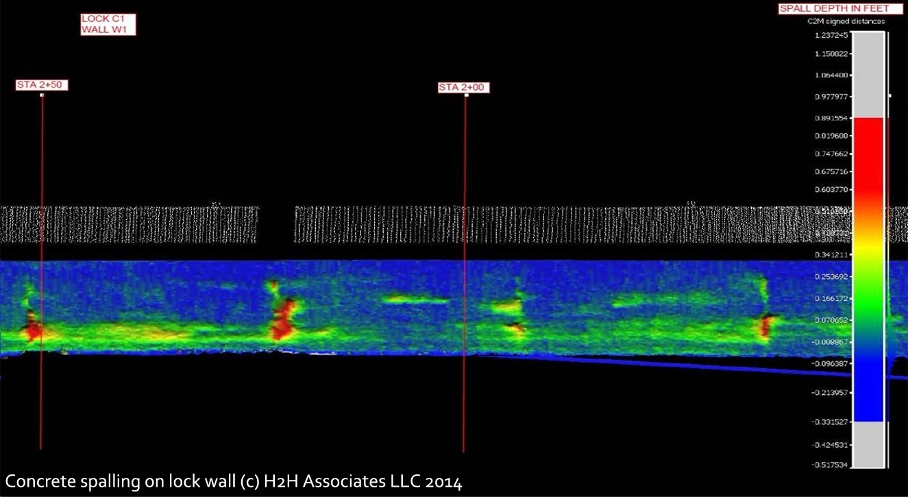
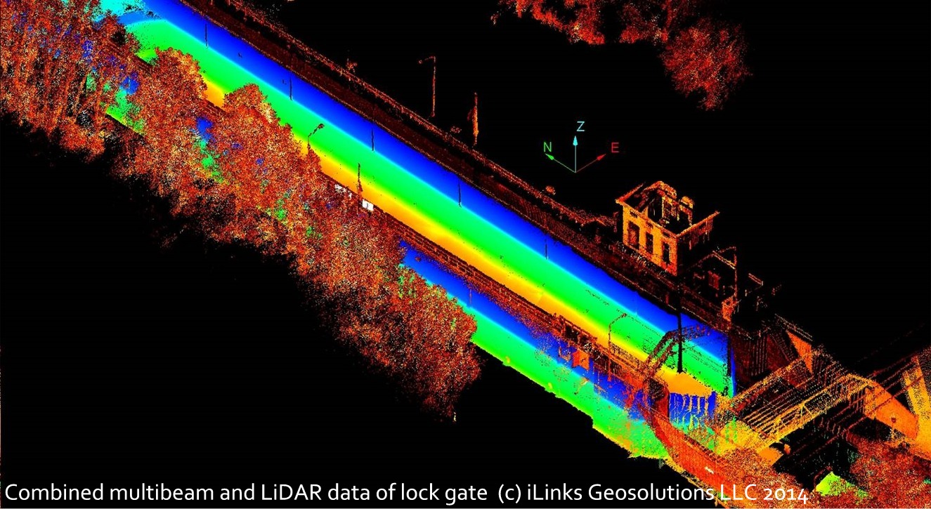
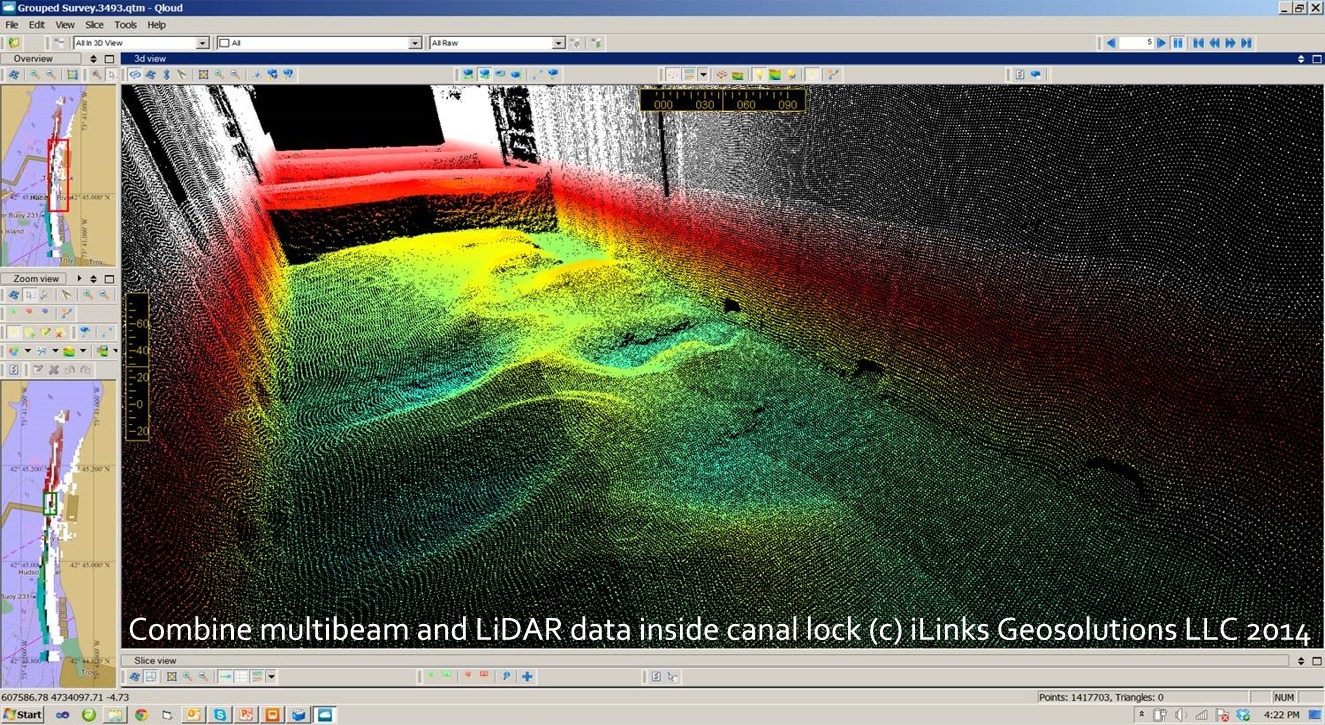
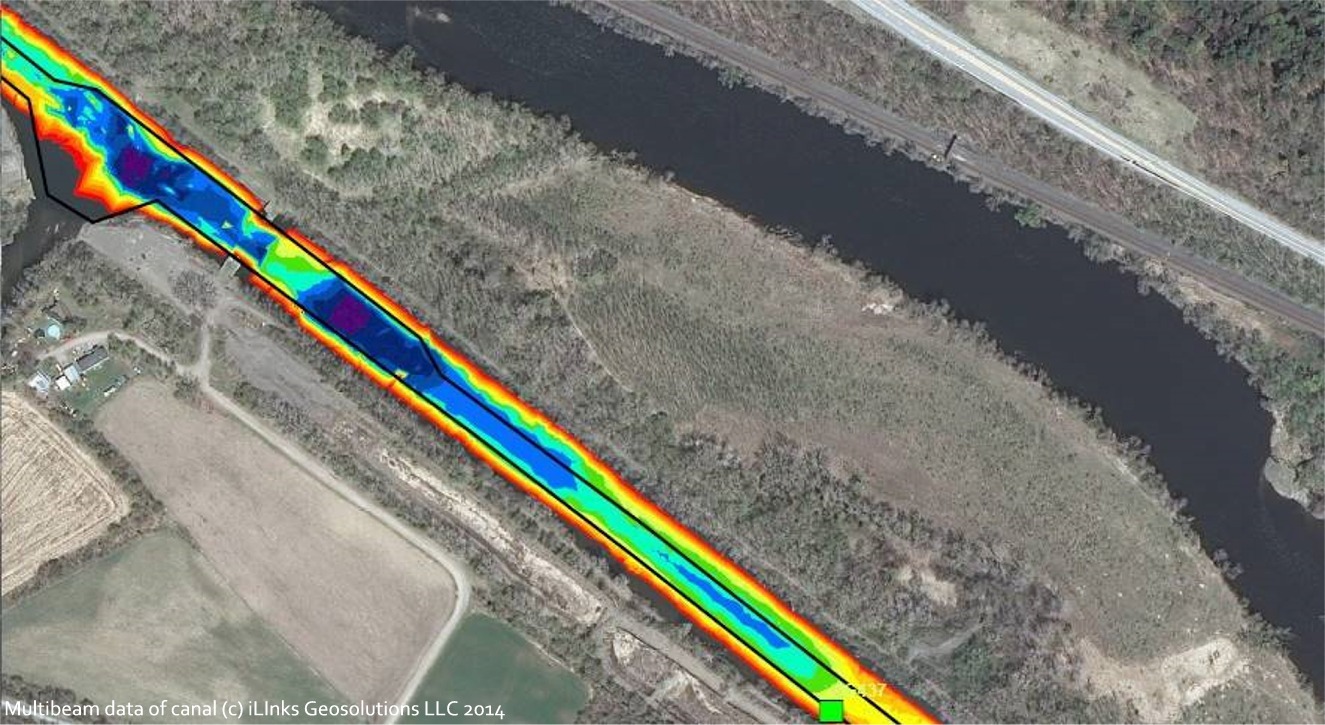
our canals systems, rivers, lakes, dams and reservoirs. iLinks developped their Rapid Deployment Survey Vessels (RDSV) for the specific purpose of producing real-time high definition 3D geospatial models of the above and below the waterline condition of inland waterways and their supporting infrastructure. Since their introduction in 2010, iLinks RDSV's have completed numerous surveys of USA inland waterways, bridges, rivers, canal systems and locks. Our Inland Waterways survey services include, but are not limited to; |
|||
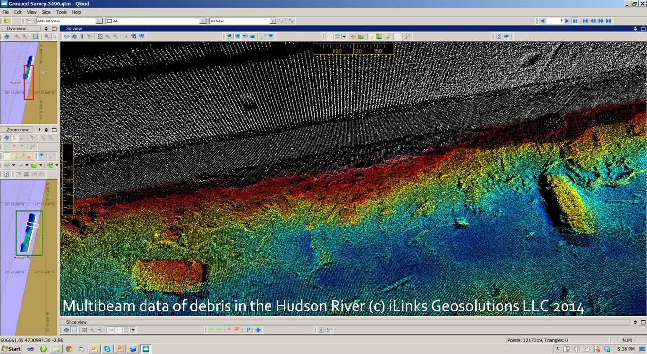
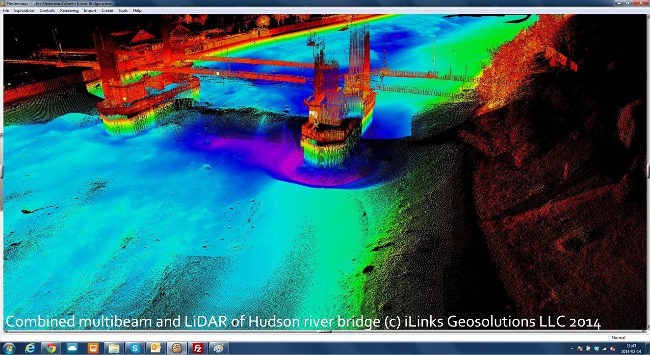
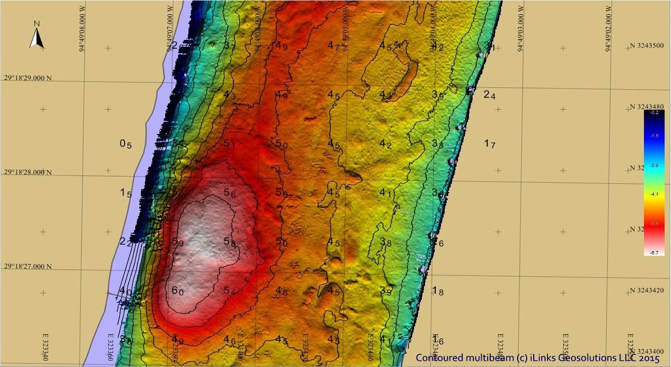
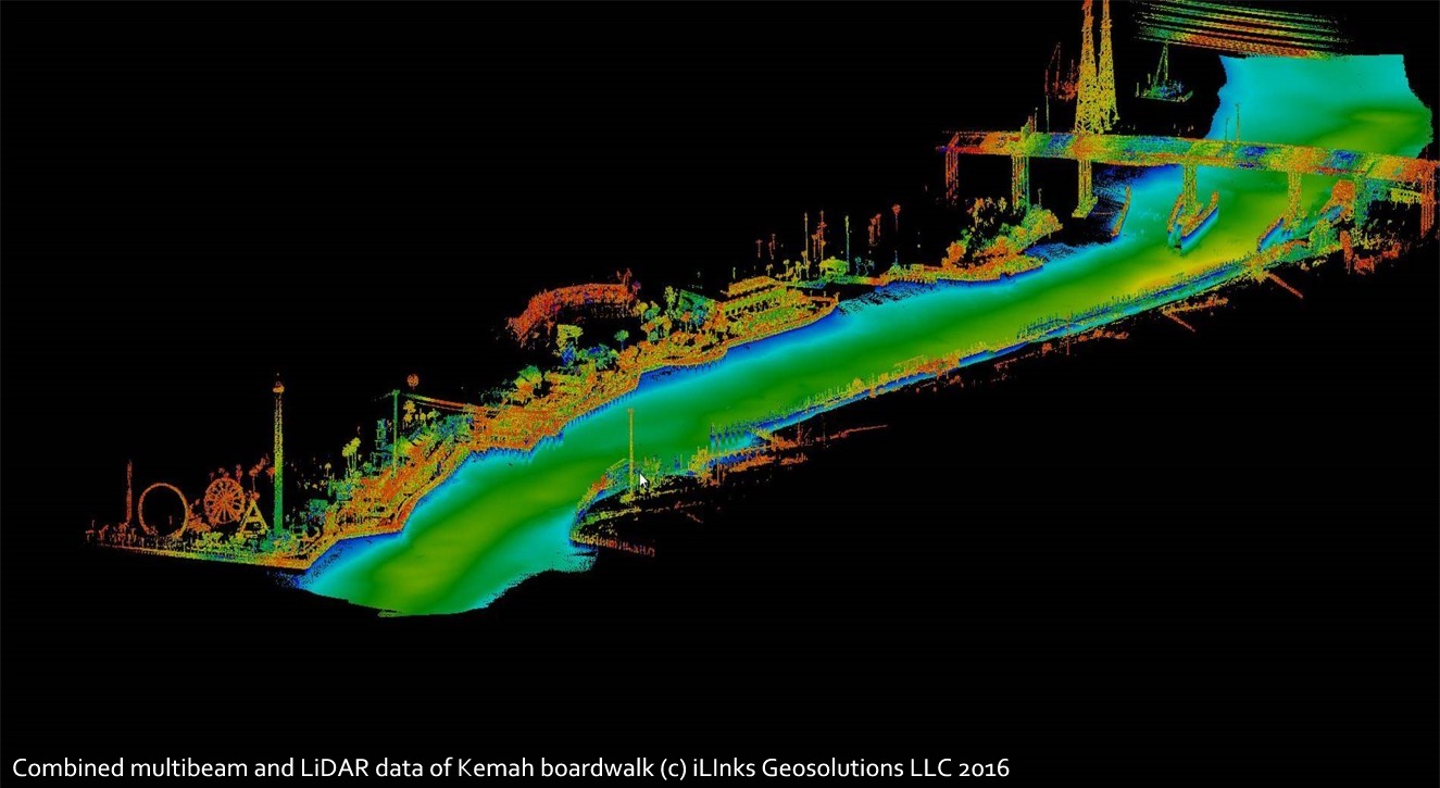
| Example data from iLinks Port and Harbor surveys | |||
 |
 |
 |
 |
| Click on image to enlarge | Click on image to enlarge | Click on image to enlarge | Click on image to enlarge |
 |
 |
 |
 |
| Click on image to enlarge | Click on image to enlarge | Click on image to enlarge | Click on image to enlarge |
| Rapid Deployment Survey Vessel - RDSV | |||
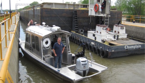
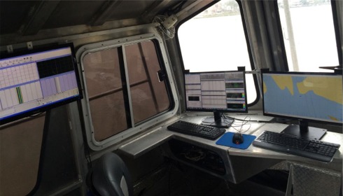
| iLinks own and operate ‘Rapid Deployment Survey Vessels’ (RDSV) which have been designed and built specifically to produce high resolution 3D Bathymetry, Side-Scan SONAR, Water Column and LiDAR data, in real-time, and with little or no post processing. The RDSV offers a number of advantages over conventional inshore survey vessels, namely; |
|
|
 |
||
 |
 |
||
|
|
|
|
|